
ArchEPI: The Tool

Aligning Real Estate Development with Community Values and Local
Climate, Health, and Equity Priorities
ArchEPI is a map-based, web tool that uses shared metrics to bring local government, community groups, and real estate developers together around the added value generated by community benefit design.
Discover ArchEPI

How it Works
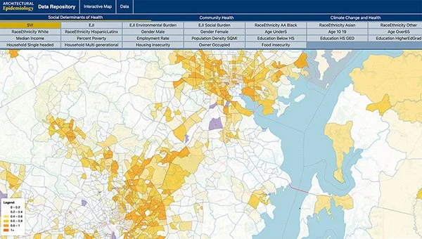
ArchEPI compiles an array of existing, openly available datasets about environmental exposures, social factors, and health outcomes into a coherent, actionable set of health priorities, associated evidence-based design strategies, and related metrics that are relevant at the neighborhood and community scales.

Demo
Walk through a model multi-family project in New York City. In a few clicks, the project team learns:
Which health topics are most important for the site
How those topics relate to local commitments
Which design strategies to prioritize
Dive into the Data
ArchEPI draws from openly available datasets from reputable sources such as the U.S. Environmental Protection Agency (EPA), U.S. Centers for Disease Control and Prevention (CDC), Federal Emergency Management Agency (FEMA), and local Open Data portals.